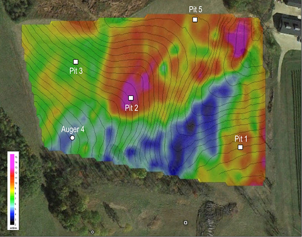
This geophysical map depicts the spatial variability of soil electrical conductivity. Ground truth data from backhoe pits and auger holes are critical for robust interpretations as the same conductivity readings can have different geologic significances at different locations.

Leave a Reply