Our interview series celebrating 100 years of the National Park Service in the United States and the important role soil plays in these parks continues. We head over to the highest peaks in central North America to speak with retired soil scientist, Lee A. Neve who worked for the USDA-NRCS for 36 years. From 1994-1998, Neve was in charge of completing the soil survey of Rocky Mountain National Park in Colorado.

Conversations with Soil Experts: An Interview with Lee A. Neve
Lee A. Neve is originally from Holland, Michigan and moved to Arizona at the age of 9, living in Phoenix, Tuscan and Flagstaff. He received a BS degree in Biology from Northern Arizona University in 1974 and a second BS degree in Soil Science from the University of Minnesota in 1977.
He was hired as a soil scientist in 1978 working in Walsenburg, CO on the Huerfano County Soil Survey until it was completed in July 1979. He transferred to Trinidad, CO to work on the Las Animas County Soil Survey at that time and stayed there until it’s completion in 2006. During the period he was stationed in Trinidad and worked on projects in Fremont Count (1980-1983), Lincoln County (1986-1987), Park County (1989-1990), Roosevelt National Forest (1990-1994), and RMNP (1995-1998). In 1983, while in Trinidad, he was promoted to Soil Survey Project Leader for the Las Animas County Soil Survey and was also in charge of crews in the RNF Soil Survey and RMNP. In 2006, he finished the Las Animas County Soil Survey publication and was promoted to MLRA Soil Survey Leader in Pueblo, CO where he remained until retiring in 2014.
What is Unique About the Soils of Rocky Mountain National Park?
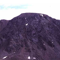
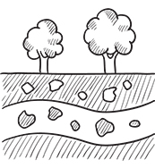
Rocky Mountain National Park consists of all mountains and valley fills that have been modified by glaciation. Many of the soils, especially the mountain slopes have very coarse textures (outwash material) with very low organic matter content. Consequently the soils are strongly acid with Ph below 5.2. Because of the acidity and coarse textures the soils have poor development. On north-facing slopes with Englemann’s Spruce canopy, we identified the first Spodosol within the state of Colorado. We also used Isotic mineralogy for several other new soils in the survey area, again the first to be identified in the stated. The valley fills were dominantly covered with a thick layer of peat, usually 10 to 20 inches thick and usually had dark mollic colors underneath. These areas were identified as important wetlands within the park.